|
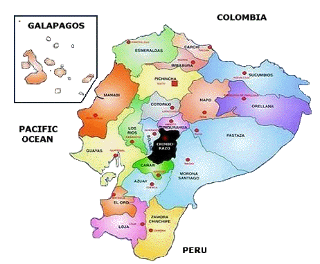
Ecuador is geographically divided
into four regions - the Amazon, the Highlands, the Coast, and the Galapagos Islands. Ecuador's coastal region consists of fertile
plains, rolling hills, and sedimentary basins traversed by many rivers
that run downwards from the Andes Mountains to the Pacific Ocean. The
Andes crosses the country from north to south. The Occidental and the
Oriental Ranges are born out of this mountain system as it divides in
the province of Loja, forming plains and valleys along the Andean
Corridor. Between the two ranges is a plateau that is three thousand
meters high.
The Amazon Region and its five provinces can be
geographically divided into two sub regions: the High Amazon and the
Amazon Lowlands. The Highlands is comprised of the Andean foothills,
which slowly descend towards the Amazon River Basin. The Lowlands,
found further to east, are home to some of the nation's most beautiful
and important rivers: the Putumayo, the Napo, and the Pastaza. The
Archipelago of Colón (commonly known as the Galapagos Islands) is made
up of 13 main islands, 17 islets, and dozens of ancient rock
formations. The volcanically formed islands, encompassing an area of
8,000 kilometers in all, lies roughly 1,000 kilometers off the coast
of the Ecuadorian mainland. Apart from its beautiful beaches and
unique and varied ecosystems, the Galapagos Islands are home to
towering active volcanoes that reach altitudes up to 1,600 meters. |